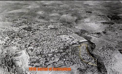
In these extraordinary early aerial photos of Jerusalem can be seen the zone once known as the City of David. In the above photo, purported to date at 1910, I have highlighted the City of David area with a thin yellow line. It constitutes a crescent shape (as described by Josephus), above the Kidron Valley. In fact, a close inspection reveals what appears to be remains of old walls defining the area (along the left side of the area enclosed with the yellow line). Many have come to believe that this is where the Temple of Solomon and the later Temple actually stood.
2 Samuel 5:7 '..and David captured the fortress of Zion, which is the City of David.'
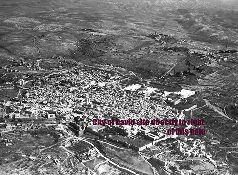
The 1930 picture (above) shows the same area in the lower right before being built up and the final picture is of more recent times. One wonders what secrets would have been revealed had archaeological digs been conducted in this zone prior to being covered in houses and other buildings as seen in the image below!
2 Samuel 5:7 '..and David captured the fortress of Zion, which is the City of David.'
The 1930 picture (above) shows the same area in the lower right before being built up and the final picture is of more recent times. One wonders what secrets would have been revealed had archaeological digs been conducted in this zone prior to being covered in houses and other buildings as seen in the image below!
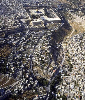
This recent arial photograph clearly shows a street now running along the west of the area and Kidron Valley on its East (or right hand side as the picture is viewed). Its crescent shape can be clearly seen.
You can get an understanding of the Biblical history of this site in the exciting narrative 'THE PLACE HaMakom: where Jerusalem's temples stood'
It's available HERE or on Amazon OR as an e-Book HERE
 RSS Feed